
Fil:Henichesk Strait.jpg
Storlek på förhandsvisningen: 800 × 543 pixlar. Andra upplösningar: 320 × 217 pixlar | 640 × 434 pixlar | 960 × 651 pixlar.
Originalfil (960 × 651 pixlar, filstorlek: 76 kbyte, MIME-typ: image/jpeg)
| Denna fil tillhandahålls av Wikimedia Commons. Informationen nedan är kopierad från dess filbeskrivningssida. |
Sammanfattning
| Beskrivning |
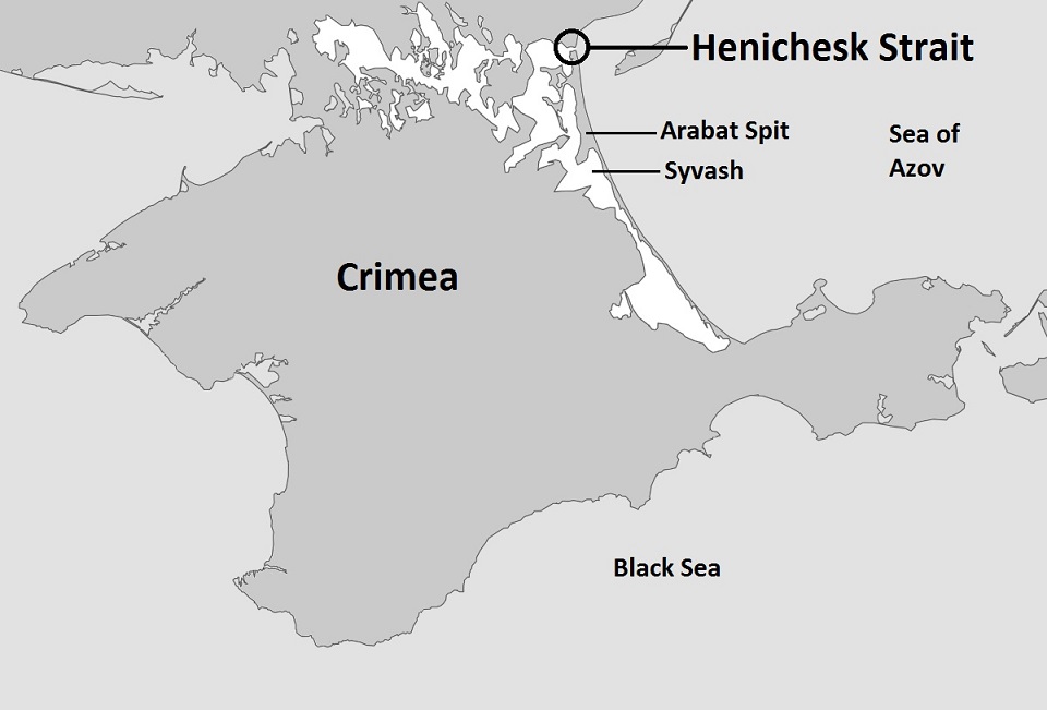
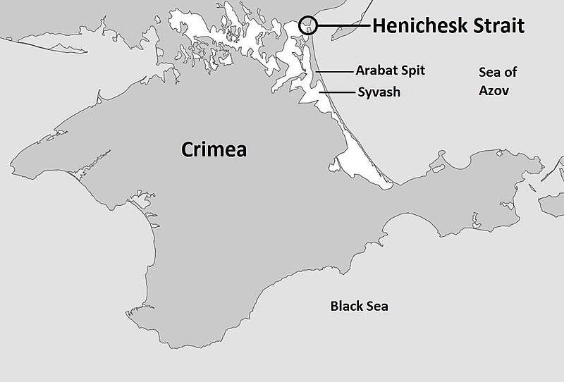
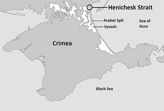
English: Map of the entire Crimea highlighting the Henichesk Strait, the body of water separating the Syvash with the Sea of Azov |
| Datum | |
| Källa | Eget arbete baserat på: Sevastopol location map.svg |
| Skapare | Kelvinsong |
Licensiering
| Detta verk har gjorts tillgänglig som public domain av dess skapare, Kelvinsong. Detta gäller globalt. I vissa länder kan detta inte vara juridiskt möjligt; i så fall: |
Filhistorik
Klicka på ett datum/klockslag för att se filen som den såg ut då.
| Datum/Tid | Miniatyrbild | Dimensioner | Användare | Kommentar | |
|---|---|---|---|---|---|
| nuvarande | 5 oktober 2014 kl. 07.10 | | 960 × 651 (76 kbyte) | Herostratus | ==Summary== {{Information |Description = Map of the entire Crimea highlighting the Syvash, the body of water separating the Crimea from the Ukraine |Source = https://commons.wikimedia.org/wiki/File:Sevastopol_location_map.svg |Date = 1 March 2014 (date... |
Filanvändning
Följande sida använder den här filen:
Global filanvändning
Följande andra wikier använder denna fil:
- Användande på en.wikipedia.org
- Användande på hr.wikipedia.org
- Användande på nl.wikipedia.org